August 1 – 31, 2005
Friday, August 26, 2005 – Buzzards Bay
Let’s see, where did we leave off?
Ah yes, the trip up BUZZARDS BAY! (creepy music in the background… flash of lightning… clap of thunder)
We awoke Friday morning to yet another beautiful day, hailed the pump-out boat on the VHF and readied Rocinante for the upcoming leg. The pump-out boat showed up in short order… an older gentleman with a white beard and straw hat shouted out an amazingly cheerful “good morning” and pulled up alongside us. I had already unscrewed the cap on the holding tank and was waiting for him to hook up his hose… this thrilled him to no end. As he went about his business of pumping out our holding tank, he commented on how so many people don’t even no where the holding tank is, don’t know what to do etc… I’ve got to tell you, this guy was truly happy! He told us how he had taken the business over from his dad, and how stupid he had been not to have done it sooner, how he spends all day out on the water and it’s not as bad as people think, etc., etc., etc.
So again, here is a guy who’s job is to literally suck crap out of peoples boats and he is absolutely thrilled… makes you think, no?
We rinsed the toilet a few more times with fresh water, just for good measure, he unhooked his hose, rinsed off Rocinante collected his $5 and went off on his merry way to his next customer! (BTW, it’s usually yours truly holding a vacuum hose down hard against the holding tank pumpout deck plate, hoping it doesn’t pop loose and shower me with you know what!)
That particular task out of the way, we topped of the water tanks and headed to the fuel dock for ice and diesel.
We left Newport behind, slowly making our way out of the harbor out to Rhode Island Sound.
I’m not quite sure what happened, but almost immediately, we started having problems telling where we were and in turn, where we were heading. Perhaps it was the fact that it was such a huge expanse of water; perhaps it was all of the buoys marking the various harbors in this particular area; perhaps it was the constant change of course to avoid the wakes created by the unbelievably self-absorbed imbeciles aboard mega-yachts prowling these waters. Whatever the cause, we missed R2, but eventually found R2a… little did we know that this was a hint of things to come.
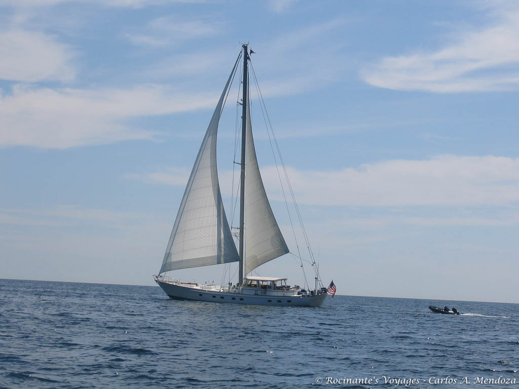
Sailboat we met along the way…
We slowly made our way towards Cuttyhunk, where we would turn north up Buzzards Bay.
The trip went without incident. It was amazing just being out there with no one in sight for hours on end… such a sharp contrast to the crowded waters around Newport.
About three hours into our journey, we turned north into Buzzards Bay… almost instantly the waters changed… still quite pleasant, but we now had two foot following seas and you could sense that it was building. Build they did, as the hours went by, the seas kept growing, first it was the occasional three footer, then those became the norm with the occasional four footer, then those became the norm… again, no big deal, but it was certainly starting to tell a story.
BTW, the thing about following seas is that while plowing through waves is not exactly fun, you are very much in control of your vessel. With following seas, they pick you up and you then slide down the back of them with little control… again, not really an issue on four footers, and all the “real” sailors out there are laughing at me right now, but with our limited experience, it was a bit unnerving.
As the day wore on, we started to really get confused… while we knew we were heading in the right direction (northish), and were generally in the right place (about the middle of Buzzards Bay), we were having a heck of a time telling exactly where we were along our plotted course. Our time and speed calculations said we were more or less where our chart plotter said we were, but the buoys we were seeing, didn’t match the paper charts or the chart plotter! Our anxiety grew with each growing wave and the diminishing light… we absolutely needed to get a fix on where we were before we got too close to the northern reaches of Buzzards Bay… we couldn’t afford to be off. To add to the tension, the constant chatter on the VHF was concerning; a 34ft cabin cruiser that had hit the rocks off Cuttyhunk and was sinking fast… fortunately, another vessel was in the area and was able to rescue the three passengers and await the arrival of the Coast Guard.
It’s getting dark, the seas continue to build… we now have six footers as the norm with the occasional eight… ok, this is no longer fun. I’ve given up on the buoys, convinced that they have all been changed since the time my charts were printed and start focusing on landmarks. We start trying to identify land masses on the charts that we see looming before us, not so easy… finally, we spot what looks to be a large radio tower and decide that based on everything else we “think” we see, we know where we are. Based on our estimated position, we decide that to our left, is Hog Island, a natural breakwater that runs parallel to the Cape Cod canal entrance channel, a great place to get a bit of protection from the building seas. We make our way towards Hog Island as the wind picks up and the seas continue to build. The next 15 minutes seemed like an eternity! Each passing eight to ten foot wave would pick Rocinante up… I would push the rudder hard to port in an attempt to control the slide down the backside and minimize the rolling effect. Down below, books, bottles and anything else not properly restrained flew off the shelves. Slowly but surely, we made our way across and in to the lee of the island. The eight footers became four footers then quickly two footers… as we made our way past the solitary sail boat anchored inside this godsend, I turned Rocinante into the wind and went forward to release the anchor… Maria backed down hard to make sure we held, we left the engine running for a bit as insurance (with the safety of land comes the danger of being pushed up onto the rocks… some safety eh?) We killed the engine, zipped up the dodger and sat. Besides helping to keep you dry, the dodger does an incredible job of shutting out the wind and the associated noise. It’s amazing how our senses work… nothing has changed, but because we can’t feel it or hear it, we feel comforted and safe.
As the tension eased, it started to sink in, we had just gone through one hell of an experience!
Exactly why we were out here… next time, it wouldn’t be as bad… after all, we had experienced it before and had survived! As we continued to calm down, we started to notice the stars above us, amazing! Smiles returned to our faces… we climbed up on the cockpit lockers and peered over the dodger into the darkness. We made dinner (don’t have a clue what we had, probably soup) and waited for the shift in tide before making the night passage through the canal to Sandwich MA.
9:45 PM… we pulled up anchor and headed out into the night to continue our trip. Needless to say, we were not exactly looking forward to heading out again, but it had to be done and so we did. As we nosed our way out from behind Hogs Island, we looked at each other and smiled, the change in tide had worked it’s magic… we no longer had the tide apposing the wind and thus, no major waves! Not quite out of the woods yet, we set the main VHF on channel 16 and the handheld to channel 13 (Cape Cod Canal Traffic Control), turned into the channel and continued north, looking for the railroad bridge marking the entrance to the Canal.
We listened intently to the VHF, the only warning we would have of an oncoming barge… about 20 minutes later, we saw the bridge in front of us. A quick radio check with Cape Cod Canal Traffic Control and we were on our way!
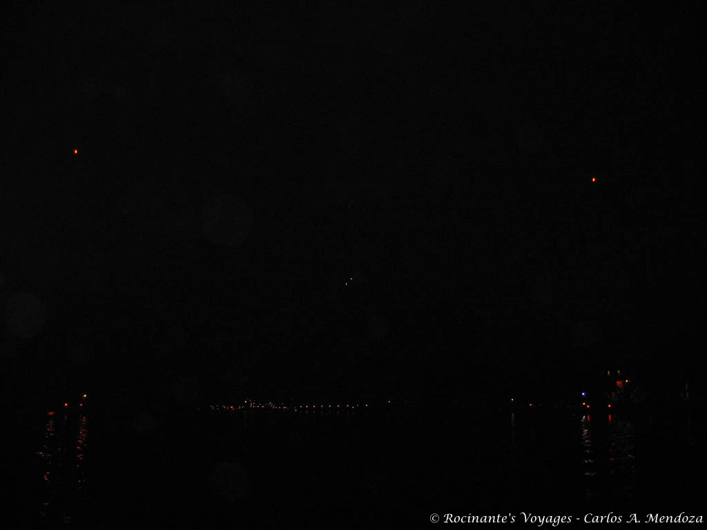
Railroad Bridge – entrance to Cape Code Canal
Yep, honest, there’s a bridge in the picture!
(The two orange dots towards the top and each end of the photo mark the top of each tower, the little green dots near the center mark the bottom of the bridge… don’t want to hit that! and the various red lights near the bottom and each end mark the stone towers… definitely don’t want to hit those!)
The passage through the canal was exactly as we anticipated… smooth as silk!
We choose to go through at night for exactly this reason, not a single boat to be seen, and only one barge passed us on the way through. The alternative was to wait for the morning tide on Saturday… to quote one of the folks I spoke to from CCCTC while planning the transit, “that’s when the Yahoos come out”… the wakes of power boats and barges bouncing off the walls would have made the 2+ hour trip miserable!
Once we saw the power plant, we knew we were approaching our destination; the eastern end of the canal was at hand. It was now around 11:30 and we longed to tie off for the night. We had reserved a slip at the Sandwich Marina in what was once a harbor of refuge… we had falsely assumed it was outside the confines of the canal. Fortunately, just off our starboard bow, I spotted what appeared to be an opening in the canal wall… far from sure, we turned towards the perceived opening and throttled back… never approach something unknown at a speed greater than you’re willing to hit it!
All hell broke loose! “Full Reverse!, Full Reverse!”
Just kidding, it was the marina… we slowly motored in looking for our slip:H29… I think there is a definite market for neon slip markers… you can’t read these things during the day, never mind at night… after a couple of turns around the marina, we decided that “this one” must be it… and if not, the heck with it, we were taking it!
We slid into our slip without incident, tied up, hooked into power and had ourselves a well earned sleep.
Till next time,
Carlos & Maria
SV Rocinante…_/)
Carlos: This is the one! This is the blog that convinced me (a), that you folks are crazy, and (b), I ain’t ever gonna find myself out in a boat where the “thrill” is that the two foot waves are now three foot waves, now four foot waves, now ….
Land is where I’m gonna be! It was an exciting blog to read ten years ago and still is today! Regards,
Phil
lol Phil!
What an amazing experience! No wonder you are willing to do it again.
“Willing”? No, chomping at the bit! lol!